This 13km starting in Benimaurell, is an incredible hike known as the “Cathedral of Hiking”. This circular route explores the Barranc de l’Infern, also known as “Hell’s Ravine”, a stunning, deep gorge that has been sculpted over thousands of years. This route is more popular and therefore well signposted as the PR-CV 147 trail. With over 6000 stone steps to climb up, this hike isn’t fo the faint hearted. But if you do attempt it, you’ll be rewarded with spectacular views, caves and incredible waterfalls after episodes of torrential rain.
Download the route on OS Maps.
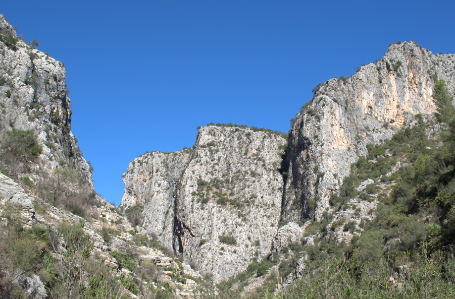
Where is the Barranc de l’Infern?
The Barranc de l’Infern is in the picturesque Vall de Laguar of Marina within the province of Alicante. Located between the villages of Fleix and Benimaurell, this deep, narrow ravine was carved over millennia by the Girona River.
Hikers will descend to cross the dried Girona River bed twice via the dramatic Forat de la Juvea, a tunnel hewn into the rock, and tackle steep zigzagging climbs that rise 800 meters. Along the trail, you’ll pass ancient dry‑stone terraces and paths, now recognised by UNESCO as Intangible Cultural Heritage . The jaw‑dropping scenery, high-altitude view, and thousands of steps make Barranc de l’Infern a hiking highlight.
Barranc de l’Infern hiking route from Benimaurell
The route starts by heading out of Benimaurell onto the PR-CV 147 waymarked hiking trail. Soon, you start heading downhill on an old stone path into the Barranc de l’Infern. These are ancient Moorish stone steps – some of the thousands you’ll be stepping foot on!

At the bottom of the gorge, you’ll cross the river bed. This is usually dry but after extended periods of torrential rain you might find that you actually have a river crossing to navigate! The path zig zags uphill along the side of the rocky gorge and through scrub bushes/vegetation.

A great place to stop for lunch is at Juvees d’Enmig, an abandoned Moorish settlement surrounded by farming landscapes marked with terraces. The trail continues to loop back down into the gorge once again before ascending steeply with fantastic panoramic views.

There is then one more rolling section to navigate before a gentle descent across the ridge, back towards Benimarurell.

Downloadable map route Barranc de l’Infern
This is a circular route through a deep gorge with rocky paths, stone steps and steep ascents and descents. The route is signposted the whole way but I recommend downloading the route onto your phone or buying a local map with the route marked on it too.
Please note that there are no facilities on this route including no natural water springs so take enough food and drink with you to last all day.
I’ve also uploaded the route onto both the Ordnance Survey App (which still tracks your GPS location on the map abroad) and Komoot so you can download the route to your phone.
Download the route from the OS App here and see the route on Komoot here. It will take around 6-7 hours to walk (not including rest stops) with around 950m of elevation.
