This 16km linear route goes from Castell de Castells to Benimaurell. The route climbs steadily a couple of times around valley heads, past a dry mountain lake, through forestry and crosses the Peñón ridgeline before descending into Benimaurell.
Download the route on OS Maps.
Where is Benimaurell?
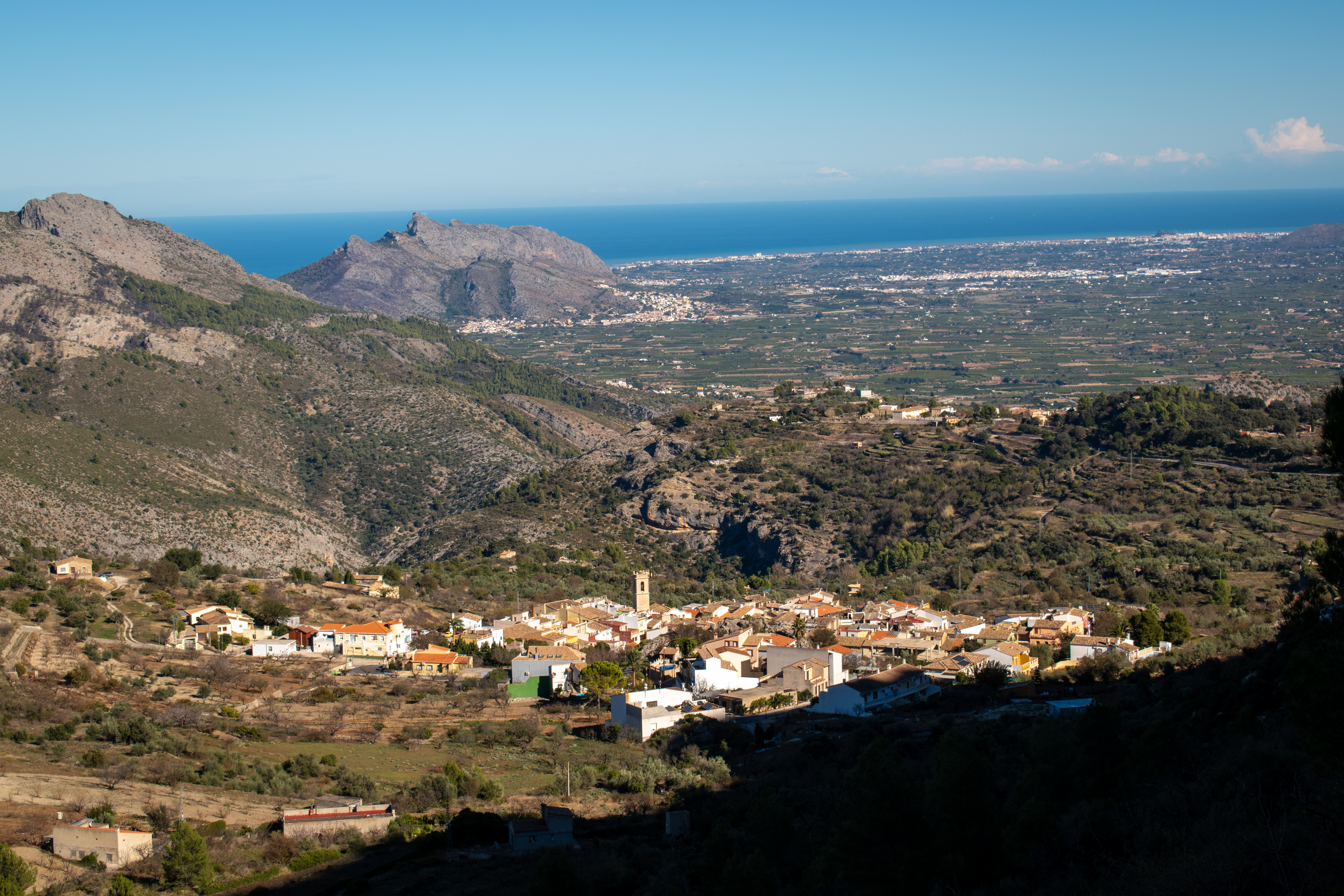
Benimaurell is a small but beautiful village in the province of Alicante with a population of less than 300. Located in the Vall de Laguar, in the Marina Alta region, it sits beneath the Peñón ridgeline and looks straight down to the Mediterranean Sea. This village was the last stronghold of the Moors until thir expulsion and the town was repopulated in 1611 by people from Mallorca. Despite its small size, Benimaurell has a lot to offer visitors; excellent hiking, authentic food and historical landmarks. It’s worth spending a couple of days here to explore.
Castell de Castells to Benimaurell linear route
The route starts by heading out of Castell de Castells and climbs steadily for around 2km until you reach the now dry mountain lake of La Llacuna. Until the 1960s it ws filled with water but apparently it was drained to make way for farming. All that remains now is a bowl shaped depression in the ground, surrounded by the hills and overgrown with shrubbery.

The walk cotinues along good forestry tracks until the head of the valley is reached with sweeping views. When I hiked this route it was remarkably quiet, as is normal with the hiking here. It’s so undiscovered.

The path then descends into the valley which is a great place to stop before the final big climb. The terrain is rocky paths leading up to a beautiful vantage point to cross the Peñón Ridge.

From here there are superb views along the Vall de Laguar and beyond. With views of the sea and the village of Benimaurell below, the walk ends with a traverse of the hillside and a final descent into the village itself.

Downloadable map route Castell de Castells to Benimaurell
This is a linear route through varied terrain with steep ascents and descents. The route isn’t signposted the whole way so I recommend downloading the route onto your phone first or buying a local map with the route marked on it.
Please note that there are no facilities on this route including no natural water springs so take enough food and drink with you to last all day. There is also very little shade and you will be out in the open for the majority of the walk.
I’ve also uploaded the route onto both the Ordnance Survey App (which still tracks your GPS location on the map abroad) and Komoot so you can download the route to your phone.
Download the route from the OS App here and see the route on Komoot here. It will take around 6-7 hours to walk (not including rest stops) with around 950m of elevation.
