Hiking in Costa Blanca is stunning and a real treat! The mountains of Costa Blanca are home to some incredible hikes and scenery but one of the best, in my opinion, is the hike to Els Arcs. The two imposing limestone arches will make you question whether you’re actually in Spain at all. The walk to Els Arcs is straightforward and there’s ample parking off the quiet roads. This is a popular walk so I recommend going for first light or at sunset to really enjoy the beauty and tranquility of this area. You’ll find everything you need to know about this hike including where to park, directions and a helpful map.
What is the hiking in Costa Blanca like?
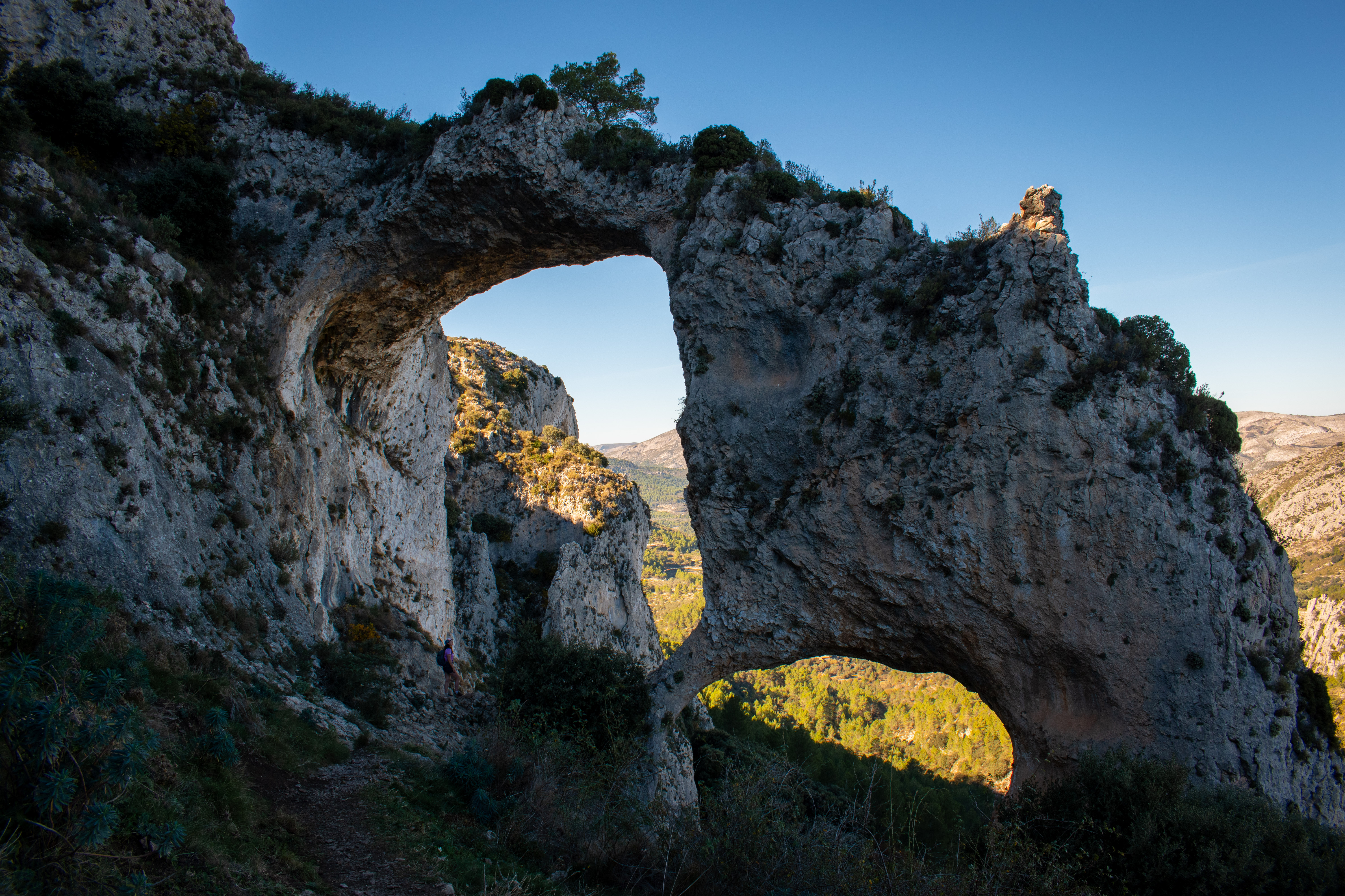
Hiking and Costa Blanca weren’t two words I would have put together in the past. I always just thought of beaches, the ocean and sunshine but hiking in Costa Blanca is incredible. Some trails are popular and get very busy however there are a lot of hidden gems and incredibly quiet paths too. Hikes are well signposted and paths are well maintained with there often being water springs along the way too. The hiking in Costa Blanca varies between gentle trails with sea views all the way up to extreme gorge hikes and scrambling. One of my favourites though is the two limestone arches of Els Arcs.
Where is Els Arcs and how do I get there?
The arches known as Els Arcs are found just off the main CV-752 road between the two villages of Tarbena and Castell de Castells. There’s a gravel area off the main road where you can park next to an information sign. The side roads around this area can be a bit iffy to take a hire car so I’d recommend parking here and walking to the arches. Find the parking area on Google Maps here.

The arches are around a 60 minute walk (one way) from the car parking area and helpfully signposted in some sections too.
Take a look at this little video I made of Els Arcs:
Directions for finding Els Arcs
From the car park, follow the track alongside the edge of the woodland until the track bends around to the right and you get to a small house. Follow the now tarmac road left around the back of the house and follow this until you meet a T-junction.
At the T-junction, turn right and follow the track again as it passes through a couple of wooded areas. It then bends sharply right behind a small building and eventually meets an intersection with a rough stony track on your right. Els Arcs is sign posted here on a wooden sign post so follow the stony track on your right.
After ten minutes or so, you’ll see another small building on your right and another stony path to your left. This is once again signposted for Els Arcs. Follow this path all the way to the base of the arches.

To return, retrace your steps back to the car.
Hiking in Costa Blanca – map and route for Els Arcs
I’ve uploaded the route onto Komoot so you can download the route map to your phone. See the route on Komoot here. This is the route for one way. The whole route will take around 2 hours not including rest and photo stops, if needed.

Please remember to subscribe to my monthly newsletter which includes my latest inspiration for adventures in the UK and abroad. It includes hiking routes, wild swimming spots and other adventure activities.
3 responses to “Best hiking in Costa Blanca: the limestone arches of Els Arcs”
[…] the way back, Oliver suggested we take a short 15 minute detour to some natural arches called Els Arcs. I’d actually hiked to these before (check out the hike here) but I knew mum would love them […]
[…] Costa Blanca region. This area is home to some of the most historically important cave painings and stunning limestone arches which you can experience on another hike in this area. Just a one hour drive from some of the […]
[…] out of the gorge, you rise out of the gorge through dramatic and changing landscapes to meet Els Arcs, the two natural limestone […]