There are some excellent linear hikes in the Costa Blanca mountains and they link up villages that aren’t too far away by road so when you reach your end point, you can get a taxi back to the start or, if you’re looking for a bigger adventure, pack light and carry your rucksack with you to the next stop. This 20km linear route goes from Tarbena to Castell de Castells and will take you through magnificent gorges, over open pasture land and alongside some fascinating natural features.
Download the route on OS Maps.
Where is Tarbena?
Within the province of Alicante, and less than 1 hr from the coast, lies Tarbena. It’s a small town with a population of 700 but is a place with an authentic Spanish feel. Its winding streets, rich history and friendly locals make this a great place for a short stopver as you start your adventure in the mountains of Costa Blanca.
Tarbena to Castell de Castells linear route
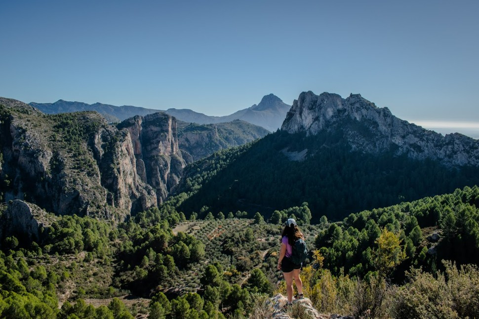
The route starts by heading north out of the village, before joining a well maintained track that quickly gains height. The route will swing left onto the Camino Rural routeand descends into the gorge below Tarbena.

This is a fabulous view point to see the Serra de Bernia, another popular hiking spot with a tunnel through the mountain to reach a fabulous view point.

Once out of the gorge, you rise out of the gorge through dramatic and changing landscapes to meet Els Arcs, the two natural limestone arches.

Finally, the route continues around the side of the valley and to Castell de Castells via a tracks before joining the main road in the town.

Downloadable map route Tarbena to Castell de Castells
This is a linear route through varied terrain. The route isn’t signposted so I recommend downloading the route onto your phone first or buying a local map with the route marked on it.
Please note that there are no facilities on this route including no natural water springs so take enough food and drink with you to last all day. There is also very little shade and you will be out in the open for the majority of the walk.
I’ve also uploaded the route onto Komoot so you can download the route map to your phone. See the route on Komoot here. It will take around 6-7 hours to walk (not including rest stops) with around 755m of elevation.

You can also view the route and download it on the OS Map App too and the GPS feature will allow you to track your progress and see where you are on the map. Download the OS route here.